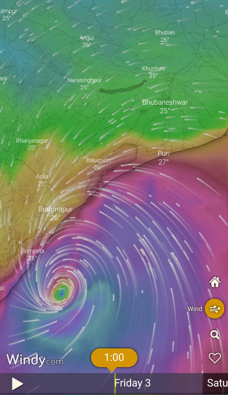
Tropical Cyclone Fani has intensified almost to Category 4 status just hours before landfall near Puri along Odisha coastline. It means life-threatening storm surge, flooding rain and destructive winds.
According to the World Meteorological Organization, cyclone Fani is now the equivalent of a strong category 4 hurricane (winds 200 – 210 km/h gusts 230 km/h), making it one of the most intense storms in 20 years.
#CycloneFani is now the equivalent of a strong category 4 hurricane (winds 200 – 210 km/h gusts 230 km/h). as it nears the Indian state of Odisha as one of the most intense storms in 20 years. #Himawari8 satelite images via @SSECRealEarth at https://t.co/YZBiiruraU pic.twitter.com/i9j4ytKhOT
— WMO | OMM (@WMO) May 2, 2019
The Indian National Centre for Ocean Information Services suggests that some parts of the Odisha and West Bengal coasts could see a surge up to almost 4 metres.
The October 1999 Category 5 cyclone produced a storm surge of 5 to 6 metres, which claimed an estimated 10,000 lives in Odisha.
The severe cyclonic storm over Bay of Bengal is expected to hit the coast of Odisha between 8 am and 10 am on Friday. The landfall will continue up to 12 pm with a maximum sustained wind speed to 170-180kmph, and gusting to 200kmph, according to India Meteorological Department.
Briefing mediapersons here, director of the Meteorological Centre in Bhubaneswar, H.R. Biswas said though the exact location of landfall is yet to be determined, it is certain that it will happen near the Puri coast.
He further said gale winds of 130-140kmph and gusting up to 150kmph are likely over the districts of Ganjam, Puri, Jagatsinghpur, Kendrapara; 90-100kmph with gusting up to 115kmph over Gajapati, Khurda (including Bhubaneswar city), Cuttack (including Cuttack city), Jajpur, Bhadrak, Balasore; 60-70kmph with gusting up to 80kmph over the districts of Nayagarh, Angul, Keonjhar, Mayurbhanj and Dhenkanal; and strong gusty surface wind speed of 30-40kmph over the remaining Odisha by evening on May 3 for subsequent 12 hours. The wind speed will gradually decrease thereafter.
Comments are closed.