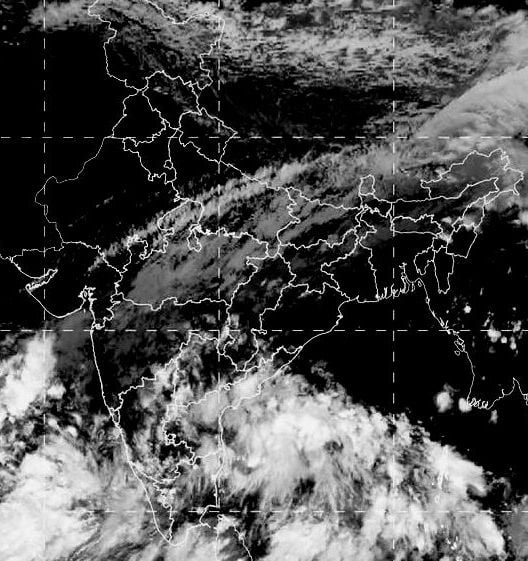
Bhubaneswar: A low-pressure area over the Bay of Bengal is likely to trigger heavy rainfall in Odisha in the next 78 hours.
According to India Meteorological Department (IMD), a cyclonic circulation formed over the south-west Bay of Bengal off Tamil Nadu coast is most likely turn into a low-pressure area over the south-west and adjoining west-central Bay of Bengal off the north Tamil Nadu and South Andhra Pradesh coast during the next 48 hours. “Under its influence, rainfall activity will begin in Odisha for two days with thunderstorm and lightning in the next 24 hours from October 22 while heavy rainfall will occur in some parts of coastal and interior districts for three days from October 24,” the IMD said in a mid-day bulletin on Monday.
In view of the heavy rainfall, IMD has issued yellow warning for one or two places in the following districts.
October 24
Gajapati, Ganjam, Rayagada, Puri, Kandhamal, Nayagarh, Nuapada and Balangir.
October 25
Gajapati, Ganjam, Sambalpur, Jharsuguda, Sundargarh, Deogarh, Angul, Keonjhar, Puri, Khurda, Nabarangpur and Cuttack.
October 26
Keonjhar, Mayurbhanj, Cuttack, Balasore, Dhenkanal, Jajpur and Nayagarh.
Meanwhile, acting on the IMD forecast of heavy rainfall, the Revenue & Disaster Management department, in a letter in the afternoon, directed the collectors of the 21 districts of Gajapati, Ganjam, Rayagada, Puri, Kandhamal, Nayagarh, Nuapada, Balangir, Sambalpur, Jharsuguda, Sundargarh, Deogarh, Angul, Keonjhar, Khurda, Nabarangpur, Cuttack, Balasore, Dhenkanal, Jajpur and Mayurbhanj to remain alert and take precautionary measures.
Comments are closed.